Category:South St. Paul, Minnesota
Jump to navigation
Jump to search
city in Minnesota, United States   | |||||
| Upload media | |||||
| Instance of | |||||
|---|---|---|---|---|---|
| Location | Dakota County, Minnesota | ||||
| Located in or next to body of water | |||||
| Inception |
| ||||
| Population |
| ||||
| Area |
| ||||
| Elevation above sea level |
| ||||
| official website | |||||
 | |||||
Subcategories
This category has the following 4 subcategories, out of 4 total.
Media in category "South St. Paul, Minnesota"
The following 18 files are in this category, out of 18 total.
-

-
 City of South St. Paul - Population Welcome Sign (39585943885).jpg 5,304 × 3,676; 20.3 MB
-
 City of South St. Paul - Water Tower (31647502618).jpg 6,978 × 4,587; 16.46 MB
-
 Commemorative Air Force Minnesota Wing.jpg 960 × 720; 321 KB
-
 Farmers Union Central Exchange 2nd HQ.jpg 4,513 × 2,702; 7.91 MB
-
 Grandview Park.jpg 1,335 × 750; 1.18 MB
-
 Kaposia Landing Rail Yard, Saint Paul, Minnesota (40438560062).jpg 4,908 × 3,212; 14.3 MB
-
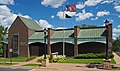
 Lawshe Memorial Museum 1.jpg 4,124 × 2,326; 2.14 MB
-
 Lawshe Memorial Museum.jpg 3,200 × 1,894; 3.76 MB
-
 Little Crow's Village on the Mississippi.jpg 480 × 305; 28 KB
-
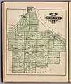 Map of Dakota County from the 1874 Minnesota State Atlas.jpg 5,604 × 6,645; 7.63 MB
-
 Map of Inver Grove from the 1874 Minnesota State Atlas (cropped).jpg 1,067 × 1,244; 425 KB
-
-
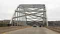 Old Wakota Bridge.jpg 1,024 × 577; 302 KB
-
 South St Paul Public Library.jpg 4,349 × 2,275; 6.95 MB
-
 South St. Paul Municipal Airport.jpg 2,274 × 1,815; 853 KB
-
 SSP Grand Ave.jpg 2,048 × 1,400; 355 KB
-
 Sstp.jpg 1,481 × 1,042; 291 KB
.jpg)
.jpg)


.jpg)


.jpg)
.jpg)


